Bitter Waters
C.M. Mayo
- Bitter Waters: The Struggles of the Pecos River by Patrick Dearen
University of Oklahoma Press, 2016
When I closed the cover of Patrick Dearen’s Bitter Waters: The Struggles of the Pecos River it was with both gratitude and the unsettling sense of having arrived into new territory— raw, rich, appalling—in my understanding of Far West Texas. This is no minor thing to acknowledge; for some years now I have been at work on a book about that very region.
But first, for those who don’t have a jones for, shall we say, Wild Westerie, why bring Far West Texas into the cross hairs? And why give a hoededo about its skinny river so salty, to quote one of Dearen’s informants, that “a snake wouldn’t drink it”?
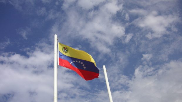
Texas is one of the most powerful economic and political entities in not only the United States but the Americas. At the same time, “Texas” is so hammered out into tinfoil-thin clichés of popular culture (and many of those informed by warmed-over 19th century war propaganda and Madison Avenue-concocted boosterism), that we have the illusion we know Texas, when in fact it enfolds concatenations of undeservedly obscure histories, stupendenous beauty, and the lumpiest of paradoxes. If Texas—and I mean the real one, not the confection of Marion Morrison aka John Wayne, et al—is still in many ways terra incognita, its “iconic” far west, profoundly moreso. What delineates Far West Texas from the rest of Texas is precisely that skinny, salty river. And a most peculiar body of water it is.
THE PECOS AND THE TRANS-PECOS
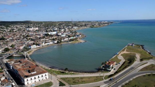
In Texas, to set foot on the western shore of the Pecos is to enter the Other Texas, the fritter-shaped, South Carolina-sized chunk of the Lone Star State also known as the Trans-Pecos.
No, Far West Texas / Trans-Pecos does not include Lubbock. Nor San Antonio. Nor South Texas, nor the Panhandle. Nor Austin, nor Dallas. Nor Midland, nor Odessa.
The southwestern border of Far West Texas is the Rio Grande, the border with Mexico; to the north, it shares a stretch along the 32nd parallel of salt fields and the Guadalupe Mountains with the state of New Mexico; and at its extreme west, the Trans-Pecos elbows into New Mexico at El Paso.
With the exception of El Paso, and the miniscule cowtown and artist-cum-hipster magnet of Marfa, few if any towns of the Trans-Pecos can raise an eyebrow of recognition outside the region.
The distances in the Trans-Pecos are stunning, never mind those to get out there from anywhere else in Texas. From the state capital in Austin, a straight shot west on Interstate 10 at the speed limit, no stops, gets you to the Pecos River near Iraan in a shoulder-stiffening four hours and twenty minutes. But the Pecos doesn’t look like much at that point—there’s a tiny sign—the highway sinks down pylons for a moment. Sneeze and you’ll miss it. You won’t catch the Pecos in your rearview mirror, either.
However, if from Austin you are game to drive four hours and thirty minutes southwest into the Lower Pecos Canyonlands, nearing the U.S.-Mexico border past Comstock you could rumble onto the high bridge over a wide and sparkling Pecos, a feat of engineering spanning a bright-walled gorge so spectacular it justifies that marathon of a drive.
And how’s this for an inkling of the scale of the Trans-Pecos itself: To drive from El Paso back to that Pecos River crossing near Iraan, 308 miles, would take at least four hours. El Paso actually lies closer to San Diego, California, on the Pacific Ocean, than to Houston on the Gulf of Mexico. (I Googled that so you don’t have to.)
West of the Pecos Texas becomes less southern, more western and more Hispanic, and drier—although there are notable ciénegas, or oases. In places the landscape rolls on as flat as a tortilla; but in others, especially around the Big Bend of the Rio Grande, the landscape turns so lasciviously volcanic it might belong to another planet.
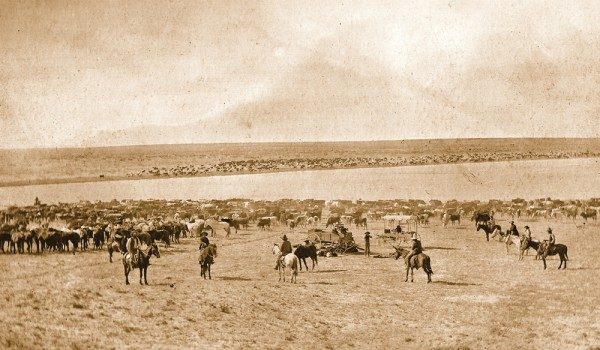
Even as the Texians and the Mexicans contested the farmlands that became the Republic of Texas (and thereafter the state of Texas), and even as the Confederates drove out the soldiers of the Union, and in turn, a victorious Union imposed Reconstruction, in effect, the remote Trans-Pecos remained part of greater Apachería and Comanchería. (That said, the Comanches did not settle in the Trans-Pecos; they passed through it on the so-called Comanche Trail—more aptly, network of trails—to raid in Mexico.) Spanish mapmakers were not far wrong to label the area the Despoblado, or Empty Quarter. The few Spanish, then Mexican, then other explorers who survived their forays into the Trans-Pecos did not have pleasant stories to tell. And so many straggled up to the bitter waters of the Pecos hoping for refreshment for themselves and their livestock only to find death. (Horse lovers should avoid reading the 1858 report of Waterman Lily Ormsby, the first through-passenger on the Butterfield Overland Mail westbound stage. Suffice to say, Ormsby mentions beating the parched and exhausted animals with rocks.)
The impetus for the U.S. government to remove the indigenous peoples—the brutal Indian Wars—and bring this merciless territory into Texas was simply this: to get to California, it had to be crossed.
A few pioneers saw opportunities in Far West Texas. In this twenty-first century some of their enterprises are still ongoing, but the Trans-Pecos is littered with ghost towns, abandoned farms, ranches, mines, and here and there at lonely cross-roads, and even on the main thoroughfares of surviving towns—Fort Stockton, Marathon, Sierra Blanca, Valentine, Van Horn, among others—there are ruins, some boarded up, most not, of houses, motels, cafés, grocery stores, and gas stations. There are many reasons for these eyesores, but a persistent one is the decline in the quantity and quality of water. All over the Trans-Pecos springs and seeps have been disappearing. As for its rivers, after the Rio Grande, the Pecos is the most important, and of all the rivers in the American West, the Pecos is one of the bitterest, most abused, and most fragile. Writes Dearen, “the Pecos is under seige by problems so vast and varied that resolutions are challenging if not impossible.”
You might assume, as I once did, that given all the movies and novels from Zane Grey’s West of the Pecos to Dearen’s own To Hell or the Pecos, the Pecos would be a well-examined river. More to the point, while there is a library’s worth of nonfiction on the Trans-Pecos—from scholarly tomes on the Paleolithic hunters, to the Spanish conquistadors, to memoirs of cowpokes and modern-day naturalists, and Dearen’s earlier works, including the invaluable history Crossing Rio Pecos— astonishingly, Bitter Waters, published in 2016, is the first book-length environmental history of the whole of this river.
THE PECOS AND THE PERMIAN BASIN
Fed by snow, rain, and freshwater springs, the Pecos gushes down from its headwaters in New Mexico’s Sangre de Cristo mountains southeast towards Texas, but before it reaches the stateline it runs into the Permian Basin. For the most part a desolation dotted with mesquites and pumpjacks, the Permian Basin is the remains of what was, some 250 to 300 million years ago, an inland sea. Layers upon layers of its ancient salts cover over yet deeper layers of the fossilized remains of marine organisms—petroleum. Only a western swath of the Permian Basin lies within the Trans-Pecos; the great amoeba-shaped body of it spreads north and east into New Mexico, the Texas Panhandle, and almost as far as central Texas. Oil rigs started popping up in the Permian Basin in the 1920s; today the Permian Basin’s industrial center is the twin cities of Midland and Odessa, about an hour’s drive east of the Pecos River.
It bears underlining that, as Dearen writes, “[s]ince time immemorial, the Pecos and its tributaries have washed across a dead sea bottom and carried away its salts.” Literally, every day, for millions of years, brine springs have been pumping tons upon tons of salts into the Pecos.
But the saltiness varies. Dearen explains that as the Pecos winds its though Texas it also drains other watersheds, and freshwater springs feed into it from the Davis Mountains. About two-thirds of its way from the top of the Trans-Pecos to its mouth at the Rio Grande, the Pecos receives yet more infusions of fresh water from creeks and springs originating in the Glass Mountains. It also receives infusions of agricultural run-off and debris, and a litany of other challenges—but this is to get ahead of the story.
“STUPID AND UNINTERESTING”
As a baseline, what was the condition of the Pecos before our time?
In the chapter “The River That Was,” Dearen provides an overview of pre-twentieth-century human encounters with the Pecos, from early peoples (some of whom, close to its source in present-day New Mexico, used its waters for irrigation), to the Spanish explorers who encountered it south of those brine feeder springs and so dubbed it the Salado (Salty River) and later the Puerco (Pig-Like). When mid-nineteenth century U.S. Army personnel encountered the “Puerco,” their reports soon began calling it the snappier-sounding “Pecos,” but they they too disdained it. Dearen quotes Second Lieutenant William F. Smith, echoing others, calling it “muddy, swift and narrow.” U.S.-Mexico boundary commissioner John Russell Bartlett, coming upon it in 1850, called its waters “brackish.” Wherever they drank from the Pecos, men and animals tended to suffer from gastrointestinal upset. In the desert, diarrhea could kill. Bartlett added: “Miserable grass.” One youthful explorer of the 1850s summed it up: “A more stupid and uninteresting river cannot be imagined.”
The first survey and and scientific study of the Pecos in the Trans-Pecos was not made until 1854, under Captain John Pope, whose mission was to find a route for the railroad to California. Pope identified areas for potential for irrigiation in the fertile lands north of the 32nd parallel, above the brine springs, in present-day New Mexico. But little could be done until after the Civil War and the conclusion of the Indian Wars.
In Texas, as early as the 1870s in the relatively less salty stretch below the town of Pecos to present-day Iraan, entrepreneurs began to divert water from the Pecos for irrigation. By the late 1880s farming commenced when the Pioneer Canal Company began to dig extensive ditches, reservoirs and small dams. These early efforts to farm in this northeastern corner of the Trans-Pecos were repeatedly wiped out in flash floods.
In 1907 a visionary rancher named T.A. Ezell decided that what Texas needed was a mega-dam on the Pecos. It would be called Red Bluff, and it would be built nearly three decades later, in the depths of the Great Depression. By that time, the banks of the Pecos River had been utterly transformed, infested by saltcedars.
THE PECOS DAMMED
In the twentieth century the Pecos River underwent a series of dramatic changes that have left it severely  compromised and increasingly fragile. Apart from the saltcedars, these largely resulted from three major dams: Red Bluff (near the border with New Mexico, built in 1936); Imperial (between the farm towns of Grandfalls, Imperial and Pecos, 1912); and Amistad (on the U.S.-Mexico border, 1969). Asserts Dearen, “Repeatedly, knowledgable observers point to the damming of the Pecos as transformational.”
Of course, the benefits of dams are substantial: they can provide water for irrigation, municipal needs, hydroelectric power, recreation, and they can help control floods, a vital concern in the Trans-Pecos, where rainfall, however rare, tends to generate devastating flash floods. (Second-order benefits may include higher asset prices, more employment, and, going to the third-order, greater fiscal revenues.)
But dams and reservoirs have ecological impacts, not all of them foreseen at the time of their construction. Above all, they tend to promote salinity. And in the already bitter Pecos, increased salinity quickly became a problem.
In Red Buff, beginning in the 1980s, blooms of golden alga began to appear. Golden alga is an invasive, possibly from England. As Dearen details in his chapter “A Fiend Unleashed,” golden alga attacks fish in two ways: its toxin affects their gills, and it depresses the levels of dissolved oxygen in the water. The fish kills at Red Bluff were so severe that for a time, Texas Parks and Wildlife closed it to fishing.
Decreased flow in the Pecos has also contributed to higher salinity. Some of this decrease can be explained by the proliferation of groundwater pumps and other irrigation wells. Farming in New Mexico draws away much of the water that might otherwise flow down into Texas (and Dearen provides lengthy discussion of the disputes). In the Trans-Pecos in the neighborhood of Imperial, twentieth century irrigation works set off a boomlet in cotton, alfalfa, vegetable and fruit farming. By the 1960s, however, with the water table down and the quality of the soil eroded, farming went into decline. (Area farms still grow the famed sweet Pecos cantaloupe, though in ever-smaller quantities).
Then there are the questions of long-term drought and climate change, which Dearen addresses briefly in quotes from residents offering their personal observations, as well as from experts. The outlook appears grim.
RECLAMATION AND ROCK ART
My two quibbles about Bitter Waters both have to with the context for these dams.
First, the discussion of issues at-hand and scope for future policy for the Pecos River would have been better grounded by an introduction, however brief, to Reclamation. For the uninitiated, The Reclamation Act of 1902 created the juggernaut first called the Reclamation Service, later the Bureau of Reclamation. Its mission is to promote development in the Western states with water projects such as dams, powerplants, and canals, and to undertake water management and water conservation. According to its official website, www.usbr.gov, the Bureau of Reclamation has constructed over 600 dams and reservoirs, including Hoover Dam, and is today the largest wholesaler of water and the second largest producer of hydroelectric power in the United States. To quote Patricia Limerick in The Legacy of Conquest: The Unbroken Past of the American West, Reclamation “put the national government in the center of the control and development of water, the West’s key resource.” The political and environmental implications have been monumental, as Reclamation’s dams, to quote Limerick again, “have changed Western rivers into giant plumbing systems.” In short, it would be impossible to understate Reclamation’s influence over the economics and environment of the West—including that of the Trans-Pecos.
Second, Bitter Waters makes no mention of the rock art of the Lower Pecos, an unparalleled cultural legacy, some of it many thousands of years old, an important portion of which was inundated by the Amistad Reservoir. The rock art sites that survive are imperiled by the rise in humidity, slight as it may seem in the desert air, from that same reservoir. The most spectacular of these sites is White Shaman, so named for its central headless white anthropomorph, which sprawls across the back wall of a rock shelter—from which one can glimpse the high bridge over the Pecos. I refer interested readers to Harry J. Schafer’s anthology, Painters in Prehistory: Archaeology and Art of the Lower Pecos Canyonlands, and Carolyn E. Boyd’s works, including The White Shaman Mural: An Enduring Creation Narrative in the Rock Art of the Lower Pecos. The latter, published in late 2016, makes a brilliant argument that White Shaman tells the story of creation, and hence it should be considered the oldest surviving “book” in North America.
INVASION OF THE SALTCEDARS
Among the most fascinating and valuable contributions of Bitter Waters is the history of the arrival of the saltcedars and subsequent attempts to eradicate them. Also known as the tamarisk, this “tree to admire and loathe,” as Dearen calls it, arrived in Far West Texas in 1886 on the wagon of one C.E. Buchholz, his idea being that saltcedars could help protect against floods. Two years later, the Pioneer Canal Company imported a second species of saltcedar from California. Native to the Levant and Central Asia, the scraggly-looking saltcedars quickly infested the Pecos. Thickets of them also cropped up along the Rio Grande, and indeed everywhere else there might be water. The list of environmental impacts includes displaced alamos (the stately native willow trees); degraded habitat for various species of birds, fish, grasses; and—ironically—a reduction of the Pecos’ ability to channel flood waters, leaving large zones in greater danger of flooding.
Bureau of Reclamation experts believed that saltcedars both raised the Pecos River’s salinity and reduced its flow. In the early 1960s the bureau launched a massive eradication campaign that, in the Trans-Pecos alone, covered 21,000 acres. Writes Dearen, “Amid soaring early expectations for a significant increase in the river’s base flow, something strange happened—nothing happened.”
In the following decades, after the construction of Red Bluff and Amistad Reservoirs, both of which increased the Pecos’ salinity, experts still took it on faith that saltcedars were displacing staggering quantities of water. Dearen quotes one expert claiming that a single large saltcedar could take up two hundred gallons a day. Ergo, so it seemed at the time, eradicating the saltcedars “had the potential to improve both the quality and vitalty of the Pecos.”
In several campaigns beginning in 1999 Red Bluff District authorities dispatched helicopters to dump Arsenal, a herbicide, on some 12,766 acres. But again, the river’s flow did not respond. One of numerous theories to account for this was that the destruction of the canopy promoted algae. Certainly algae had become a problem. In any event, the saltcedars returned, and worse: in torrential rain in 2014, the still unburned debris of those thousands of poisoned-to-death trees swept down the upper Texas stretch of the Pecos, causing half a million dollars’ worth of damage to croplands and infrastructure.
The widely quoted assertion that a single saltcedar could suck up two hundred gallons a day? That was pulled out of someone’s Stetson. As for saltcedars contributing to the Pecos’ salinity, Dearen notes a 2008 study that showed that saltcedars were not, after all, significant.
Nonetheless, a more exotic scheme to attack the saltcedar was afoot. In its Old World native habitat, the saltcedars had insect predators… As I read Dearen’s account of a U.S. government entomologist importing leaf beetles in his land-luggage, I could not help but envision this as the opening scene in a tragicomic novel.
To date, a number of different species of saltcedar munching beetles have been released on the Pecos. Jury’s out.
AN ESSENTIAL FOUNDATION
In his preface Dearen expresses the hope that Bitter Waters might “provide an essential foundation for the next generation of endeavors and policies.” Unquestionably it does, and its detailed maps and photographs help bring an amply-documented narrative into especially crisp focus.
But Bitter Waters also represents a stellar contribution to the literature on the Trans-Pecos itself, and as such, to the environmental history of Texas and the Southwest, for the Pecos River is fundamental to understanding the region in all its many facets, not only ecological, but also cultural, economic, geological, historical, and political.
And more: in the microcosm of this environmental history of the Pecos River, we may more clearly perceive the macro-catastrophe of our planet’s degradation, and, in my view, its three powerful motors: First, what economists call “the tragedy of the commons”—in the absence of well-specified and enforced limits, we to tend to overexploit shared resources; second, ye olde Road to Hell, that is, the one paved with good intentions—interventions that did not anticipate systemic consequences; and third, the advent of the oil industry, for without oil to fuel agriculture, construction, and transportation, such rapacious demands upon this bitter river, and projects to manage it, would never have been viable.
*Originally published in the Marfa Mondays blog, April 17, 2017
 C.M. Mayo is the author of Metaphysical Odyssey into the Mexican Revolution: Francisco I. Madero and His Secret Book, Spiritist Manual(Dancing Chiva, 2014) which is translated by Agustín Cadena as Odisea metafísica hacia la Revolución mexicana: Francisco I. Madero y su libro secreto, Manual espírita (Literal Publishing, 2014). Her website is www.cmmayo.com
©Literal Publishing
Posted: April 30, 2017 at 6:20 pm